Thứ Tư, 19 tháng 10, 2016

The West Coast of South Sumatra in Lampung Province, "A Paradise For Surfers and Bodyboarders"

 
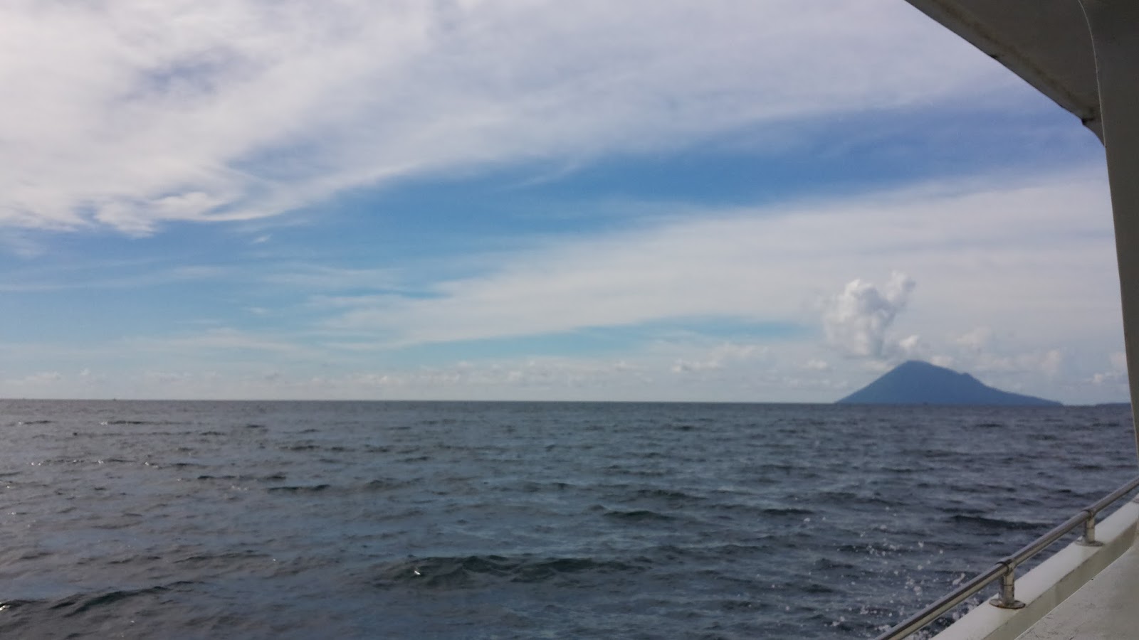
The Sea View of The Southernmost of Sumatra Island.

Geographically, the province of Lampung is surrounded by sea waters. Adjacent to the south, Lampung is separated from Java by the Sunda Strait, in ​​the east coast by the Java Sea and the west coast by the Indonesia Ocean.This geographical setting makes Lampung Province rich in beaches measuring as long as 1167 km and dotted with as many as 169 big and small islands which have the potential as  maritime and beach tourism destinations including Sumatra coastline along the west coast of Pesisir Barat regency with Krui as the capital city.


Hidden behind the strip of highland range called Bukit Barisan, parallel along Sumatra coastline, there lie at least 17  beaches and marine tourist points spread in 11 Kecamatan, or districts, in Pesisir Barat regency covering around 210 km long of the coastline. The districts include: Kecamatan Bengkunat Belimbing, Kecamatan Bengkunat, Kecamatan Ngambur,Kecamatan Pesisir Selatan, Kecamatan Krui Selatan, Kecamatan Pesisir Tengah, Kecamatan Way Krui, Kecamatan Karya Penggawa, Kecamatan Pesisir Utara,Lemong, and Kecamatan Pulau Pisang.


Tanjung Setia in Kecamatan Pesisi Selatan is the most favorite site of surfing and bodyboarding among foriegn tourists visiting Pesisir Barat regency. Perfect waves are characteristic of Tanjung Setia Beach as shown by the height that reaches 6 to 7 meters. This makes the beach a destination of surfing from around the world, high waves on the shore is usually held in June until August. The waves there are not only high but also has a length approximately 200 meters.


Located around 273 km or 5 hour drive from the provincial capital of Bandar Lampung, in the village of Tanjung Setia, West Lampung, Tanjung Setia Beach is hit by consistent swell from the Indian Ocean. Although not so well known as those in Bali and Lombok or Nias Islands, according survey among visiting surfers from all over the world the waves at Tanjung Setia Beach is touted as one of the best waves in the world. The waves parallel to the one in Hawaii. Locations of diving here rated legendary among dive enthusiasts.

Visiting the Lampung west coast in the vicinity of Tanjung Setia offers you at least 12 quality surf breaks. You can surf in the following surf breaks : Honey Smacks, Jenny's point, Jimmy's Left, Jimmy's Right, Krui Left, Krui Right, Leftovers, Mandiri Beachbreak, Pulau Pisang (Banana Island), The Peak, Ujung Bocur - Karang Nyimbur, Way Jambu (Sumtra Pipeline), and surfbreaks yet unnamed and unspoiled. For more visit http://www.surfsouthsumatra.net

There is a number of reasons why should try surfing in the South Sumatra coast. First, all surf spots are easily accessible from the main road heading south north along Sumatra coastline, from  around 100 m to 500 m. Second, The average crowd on the main surf breaks is 10 to 30 during peak season (May - early October) and 5 to 25 during the off season (November - April), the weather from November to April can be severe with the wind howling in from the Indian Ocean during the period the locals call the Windy Season.Third, the incredibly friendly locals always happy to give directions,particularly, when venture out to explore the unnamed yet unspoiled surf breaks. The last but not least, there are other attractions you can do here like visiting the UNESCO’s World Heritage Listed Bukit Barisan Selatan National Park (BBSNP) as it offers guided day tours if your surfed out or would just like to explore the Sumatran jungle.

 Source: http://www.surfsouthsumatra.net

Note: this page owes a lot of thanks to Mr. Milosav for quoting some materials in the reference.

Thứ Ba, 18 tháng 10, 2016

Visit "The Old City" of Jakarta: The VOC Shipyard.


The VOC (Vereenigde Oost Indische Compagnie) shipyard,galangan VOC, is another historical site in northern region of Jakarta. Located at Jalan Kakap No. 1 Kelurahan Penjaringan, North Jakarta, the shipyard was established about three hundred years ago ,when Jakarta was named after Batavia.


This building lies in an area called as Pasar Ikan, or Fish Market, which once became a major trading center in Asia.  Built on 2000 meter sq, the VOC Shipyard can not also be separated from a number of buildings and places of cultural heritage in the vicinity, namely Menara Syahbandar, Maritime Museum, as well as Sunda Kelapa harbour. The Maritime Museum was formerly used for spices barn; and Syahbandar Tower was formerly functioning as the navigation of ships in the port of Sunda Kelapa.


The building was built in 1628 and then used as the headquarters of VOC (Vereenigde Oost Indische Compagnie). Formerly, the shipyard was used as a place to store and repair large ships before sailing into the open waters for months or even years. In addition to large vessels, there were also small boats made here.
 
Cafe and Resto in the VOC Shipyard.
This two-level building has shifted in its function. In addition to Cafe and Resto, this place is also often used as a function hall for various events, such as weddings or other large events.There is also a gallery of paintings and gold coffin known as a storage of valuables size 1 M X 1.2 meters.


Chủ Nhật, 16 tháng 10, 2016

Visit "The Old City" of Jakarta : Sunda Kelapa Harbour.


Sunda Kelapa Harbour.
Sunda Kelapa Harbor is located in the Penjaringan sub-district, Penjaringan, North Jakarta and is known as one of the tourist destinations in the Old City of Jakarta. The Port is  said to have been established since the 5th century, and until now this port still serves as a trade port. Sunda Kelapa Habour is also a historic site that became the forerunner of the City Jakarta today, and has a long history of well-known at home and abroad.


Sunda Kelapa is an old harbour of Jakarta, located on the estuarine of Ciliwung river. Originally, it was the main port of Hindus Kingdom of Padjadjaran but today still serves inter-island freight shipment by Pinisi, a traditional two masted wooden sailing ship. This port is located in Penjaringan subdistrict, North Jakarta, with address: Jl. Maritim Raya, RT.11 / RW.8, Ancol, Pademangan, North Jakarta City, Jakarta Raya 14430.
Sunda Kelapa Harbour Overshadowed by Apartment.

Thứ Sáu, 7 tháng 10, 2016

Visit "The Old City of Jakarta" : Kota Intan Drawbridge.


Kota Intan Bridge was built in 1628 by VOC ; thereafter several name changes. The name of Engelse Brug  was given as the bridge connected the Dutch Fort and England Fort, located at Kali Besar (Great River). The bridge the was broken as a result of Banten and Mataram attacked Batavia Castle 1628 and 1629. It was rebuilt in 1630 by the Dutch and known as De Hoender Pasabrug (Chicken Market Bridge) because it was close to chicken market.

Kota Intan was the last name. It is assumed the name relates to its location which was close to one of Batavia Castle bastion Named Bastion Diamant (Intan-Diamant-Diamond). In 1938, the bridge was reconstructed to a drawbridge so the boats can pass and to prevent flooding which often happened. The shape and style was not changed but the name changed to Opshalbrug Juliana or Juliana Benhard. This drawbridge was only kind of remainder of that kind that the Dutch had ever built.


Thứ Tư, 5 tháng 10, 2016

Visit Lampung Province 2017, " The Treasure of Sumatra ".

The View of Lampung Bay with Bandar Lampung at the background.
Lampung is a province of Indonesia on the southern tip of Sumatra Island covering a total area of 35.587 km2, with Bandar Lampung as the capital city. Geographically,Lampung Province is located East - West between: 103º 40 '- 105º 50' East Longitude, and North - South between: 6º 45 '- 3º 45' South Latitude.

Tropical Rainforest Heritage of Sumatra is located in Sumatra Topography 

Located on the southernmost of Sumatra Island, Lampung province is surrounded by oceans. Adjacent to the south, Lampung is separated from Java by the Sunda Strait, while the area of ​​the east coast by the Java Sea and is situated adjacent to the west coast of the Ocean Indonesia.

This geographical setting makes Lampung Province rich in beaches and small islands which have the potential as  maritime and beach tourism destinations. A marine tourism destination which is gaining popularity among domestic visitors in Lampung is Teluk Kiluan or Kiluan Bay. It lies in Pesawaran Regency and is situated on migration path of dolphin making it a perfect site for dolphin watching. 


Surrounded by sea waters, Lampung Province offers a lot of marine and beach tourism destination along Lampung bay, which is administratively shared by four regencies : South Lampung, Bandar Lampung City, Pesawaran Regency, Tanggamus Regency, there lie an array of  tourism sites, frequently visited by locals as well as domestic tourists. Among the beaches are Pantai Guci Kapal Batu, Pantai Wartawan in South Lampung; Pantai Pasir Putih in Bandar Lampung, Pantai Queen Artha, Pantai Duta,Pantai Klara, Pantai Mutun and Pulau Tangkil, Pantai Sari Ringgung, Pulau Pahawang, Pantai Tunjung Putus in Pesawaran Regency; Pantai Piabung in Tanggamus Regency.

 
Facing directly to Indian Ocean, Pesisir Barat Regency endowed with hundreds kilometer long coastline is very potential to be developed into International surfing destination in Lampung. This area is a wave rich  surf zone- rights, lefts, and beachies. Swell sizes range regularly between 6-12ft from March to November and 3-6ft throughout the rest of the year. Hardly no crowd like in Bali or Lombok beaches, make it a perfect destination for surfers and bodyboarders.
Bodyboarding at Krui Beach, Krui, Lampung.
There are many beaches along the coast. The west coast of Lampung Province offers at least 17 beach attraction sites including Tanjung Setia Beach, Selalau Beach, Way Jambu Beach, Labuhan Jukung Beach, Way Haru Beach, Way Sindi Beach, and Suka Negara Beach. 
Aerial view of Tanjung Setia, Pesisir Barat Regency, Lampung.
Tanjung Setia Beach is already well known internationally as "A Paradise for Surfers and Bodyboarders". High season is from May to Mid September and this is a very popular time for Australians and New Zealanders, from Mid September to November you will find more guests from Europe.From November through the off-season you will find travelers from Korea escaping the winter at home.  (http://www.surfsouthsumatra.net)
 
Topographically, Lampung province mainly consists of highland and lowland zones. the highland zone is made up of the areas covered by mountain ranges called Bukit Barisan,known as the 'Andes of Sumatra’,  which spans from the northern most part of Sumatra Island mostly occupied by Nanggroe Aceh Darussalam (NAD) to the southern most of Sumatra Island covered by Lampung province. It is on this well known key spine of Bukit Barisan lying a UNESCO World Heritage Site, the Tropical Rainforest Heritage of Sumatra consisting of three national parks: Gunung Leuser National Park (GLNP) in NAD, Kerinci Seblat National Park (KSNP) in Jambi Province and Bukit Barisan Selatan National Park (BBSNP) in Lampung Province.
Head Office of BBSNP in Kota Agung, Tangggamus Regency.
Bukit Barisan Selatan National Park is a national park with a total area of 3,568 km2, spanning three provinces in southern Sumatra : Lampung, Bengkulu, and South Sumatra , in average only 45 km wide but 350 km long stretching along the Bukit Barisan mountain range.Topograpahically,the northern part of BBSNP is mountainous with its highest point at Gunung Pulung (1,964 m), while its southern section is a peninsula covering Bandar Lampung city with Lampung bay at the end point. It is covered by montane forest, lowland tropical forest, coastal forest and mangrove forest.

Guard Station in Rhino Camp of BBSNP.
Plants in the park include Nipa palm, Casuarina equisetifolia, Anisoptera curtisii and Gonystylus bancanus, as well as Sonneratia, Pandanus, Shorea and Dipterocarpus species. Large flowers in the park include the Rafflesia arnoldii, Amorphophallus decus-silvae, Amorphophallus titanum and the world's largest orchid the Grammatophyllum speciosum.The park is home to many endangered and threatened species, including:
  • Sumatran elephant (about 500 animals, or 25% of the total remaining population of this subspecies live in the park)
  • Sumatran striped rabbit (most recent records of this poorly known species have been from the park)
  • Sumatran rhinoceros (an estimated 60-80 Sumatran rhinos live in the park; approximately the same number live in Gunung Leuser National Park, and when combined the two parks account for the majority of this species' population)
  • Sumatran tiger (approximately 40 adult tigers or 10% of the remaining Sumatran tigers live in the park).
Other animals in the park are the Malayan tapir, siamang, Sumatran surili, sun bear and lesser mouse-deer. There are over 300 species of bird in the park, like the critically endangered Sumatran ground-cuckoo.
The Offspring of Rafflesia arnoldi at Rhino Camp, BBSNP.
While highland zone mostly on the west side, lowland zone which make up most of land coverage is situated on the eastern side of Lampung province.  The landscape of lowlands is mostly dominated by land coverage with swamps, mangrove and complex river systems.

Way Kambas National Park is among the  land coverages in the eastern part of Lampung Province. Way Kambas National Park is a national park covering 1,300 square kilometres in Lampung province, southern Sumatra, Indonesia   consisting of swamp forest and lowland rain forest. The park still has a few critically endangered Sumatran tigers, Sumatran elephants and Sumatran rhinoceroses. It also provides excellent birdwatching, with the rare white-winged wood duck among the over 400 species present in the park.
Elephants roaming in Way Kambas National Park.

Source: Wikipedia

Thứ Hai, 26 tháng 9, 2016

Visit Bunaken National Marine Park in Manado, North Sulawesi.

Bunaken Beach, Manado.
 Bunaken National Park is a marine park in Bunaken island, North Sulawesi.The park is located near the centre of the Coral Triangle, providing habitat to 390 species of coral as well as many fish, mollusc, reptile and marine mammal species.The status as a National Park was formally established in 1991 and is among the first of Indonesia's marine parks.

Old Manado Mount, Across Manado.
The marine park covers a total area of 890.65 km², 97 percent of which is marine habitat while the remaining 3 percent of the park is land, consisting the five islands of Bunaken, Manado Tua, Mantehage, Nain and Siladen.Bunaken marine park located about 7 miles from the port of Manado and can be reached in 30 minutes by fast boat.

pulau bunaken manado
The beauty of Bunaken marine park could no doubt for tourists who like diving, snorkeling and surfing. It is not complete without a visit to the city of Manado visited tourist sites on this one. In other words Bunaken marine park is an obligatory destination for tourists who visit the city of Manado.
This island you can see the beauty of the underwater world that can please your eyes as well as refreshing your mind, various coral reefs of various shapes, and various types of marine life such as turtles, mandarin fish, seahorses, stingrays, and if you're lucky you can see the ancient king of ocean fish (the coelacanth) and many other marine life
diving bunaken park
  • Siladen
In the marine garden, other tourist attractions you can visit is the island of Siladen. The beauty of Siladen is not less than to the beauty of Bunaken Island. Siladen located on the northeast of the island of Bunaken and can be gone for about 45 minutes by boat. The island area of 31.25 ha is surrounded by white sandy beaches and of course the underwater scenery is decorated with various kinds of coral reefs and marine life of different shapes and colors.
siladen resort
  • Manado Tua
Manado Tua is the largest island among the group of islands within the limits of Manado bay. To reach the island which is about 10 miles from downtown Manado, you have to travel about 60 minutes by boat. This island there are volcanoes towering trees and overgrown green and leafy. Not much different to the Bunaken marine park and Siladen, the waters in this area has spectacular underwater panorama.
Manado Tua

Thứ Hai, 19 tháng 9, 2016

Cultural Festival of Floating Market 2016 in Banjarmasin, South Kalimantan.


South Kalimantan is set  to entice the arrival of  local and international tourists by holding Cultural Festival Floating Market. This exciting event is, coincided with the 490th anniversary of Banjarmasin , held in Siring, Martapura River, Jalan PierreTendean, Banjarmasin, on September  from 16 to 20, 2016. This event has been held eight times this year.

During the five days of the festival in the eighth time, various art and culture activities of South Kalimantan, will be presented including the parade and ornamental boats on the Martapura river.There are nine competitions held in the Cultural Festival Floating Market including competition of Cultural Parade, Banjar Fashion Carnaval, Festival Sinoman Hadrah,  Traditional Games Balogo Competition , Culinary Festival Area at Kampoeng Banjar, Sasirangan Street Festival, Cooking Competition of Hotel and Restaurant Chefs,Ornamental Boat Competition among Floating Market Traders and Photo Competition  with objects from  Floating Market Festival.

In addition to being a permanent agenda of provincial government, the cultural festival floating market also has become an annual event of tourism calendar in the Ministry of Tourism. Therefore, promotion and publicity not only a national scale, but also can be seen in overseas travelers through the website of the festival.The annual festival aims to develop the local tourism industry. The tourism industry is expected to support the regional economy in the midst of the decline of the mining industry in South Kalimantan.

Source:  http://www.pontianakpost.com/wayang-ajen-bakal-tebar-pesona-di-festival-budaya-pasar-terapung

Bài đăng phổ biến