Hiển thị các bài đăng có nhãn Nature. Hiển thị tất cả bài đăng

Thứ Năm, 24 tháng 11, 2011

Komodo Dragon

Real dragons spurt no fire, have no need to fly and cast no magic spells. And still, one look from them might render you speechless. These komodos, the real life dragons, are a sight indeed. Gigantic, the lizard-like creatures are about two or three meters in length. They can easily weigh about 165 kilograms. Despite of their sheer size and appearance, they are not active hunters. What makes them intimidating is the fact that they are a patient predator. In the wild, they stalk a victim, usually a weak or injured one. One bite and that's what it usually takes. After following the victim for a while, sometimes up to several days' time, the komodos will devour the dying prey.

The Komodo Dragon (Varanus komodoensis) is an endangered species which can only be found in the Komodo National Park (KNP) in East Nusa Tenggara (NTT). Because of the unique and rare nature of this animal, KNP was declared a World Heritage Site by UNESCO in 1986.


The park includes three major islands, Komodo, Rinca and Padar, and numerous smaller islands together totaling 603 km2 of land. The total size of Komodo National Park is presently 1,817 km2. Proposed extensions of 25 km2 of land (Banta Island) and 479 km2 of marine waters would bring the total surface area up to 2,321 km2.At least 2500 Komodos live in this area. Large dragons are usually three meters long and weigh up to 90 kg. Their habitat has beautiful panoramic views of savannas, rain forests, white beaches, beautiful corals, and clean blue seas. In this area, you can also find horses, wild buffalo, deer, wild boar, snakes, monkeys, and various types of birds.

KNP has a rich and amazing underwater sea biotica. Divers claim that Komodo waters are one of the best diving sites in the world. It has fascinating underwater scenery. You can find 385 species of beautiful corals, mangrove forests, and seaweeds as a home for thousands of fish species, 70 types of sponges, 10 types of dolphins, 6 types of whales, green turtles and various types of sharks and stingrays.

Or you can do some diving activities in Komodo Island. Go this link if you want to see more information about it.

Thứ Năm, 17 tháng 11, 2011

Anambas Archipelago, Riau


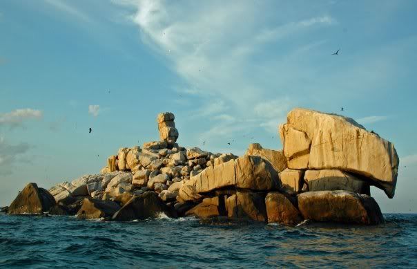
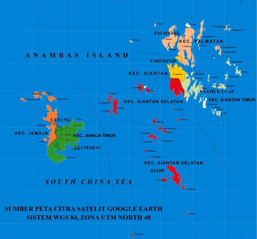
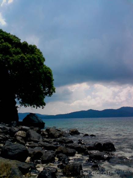
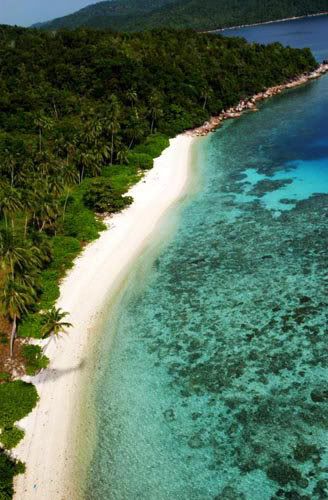
Anambas archipelago (Indonesian: Kepulauan Anambas) is a small archipelago of Indonesia, located in the South China Sea between the Malaysian mainland to the west and the island of Borneo to the east. Geographically part of the Tudjuh Archipelago], it is administratively a regency and part of the Riau Islands Province.


Get There (source)
By Air:
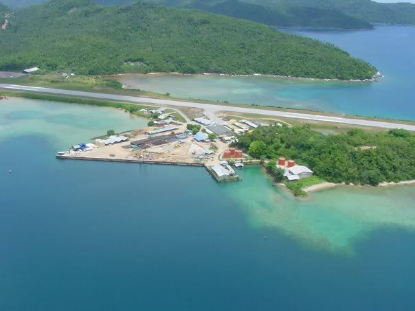
Anambas is served only by Riau Airlines which flies to Pulau Matak, "gateway" of the Anambas Islands . This airline operates thrice weekly Fokker-50 flights from Tanjung Pinang's Kijang Airfield on the Island of Bintan. Bintan is connected by hourly fast ferry from Singapore. If you leave from Singapore at 07.00AM by boat to Tanjung Pinang on Bintan, you are able to connect to the Riau Airlines flight which brings you on the ground in Matak Airfield at 12.00 Noon. The airport, owned by ConocoPhilips for offshore drilling and natural gas explorations, also serves as a domestic terminal .


By Boat:
Best is to travel to and around Anambas by yacht or live-aboard from Singapore, Batam or Bintan.
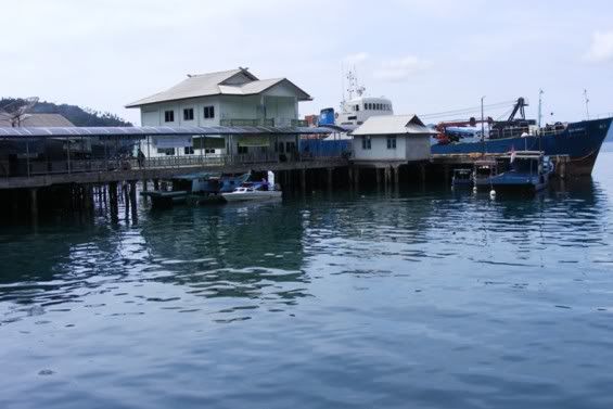
Twice a month the Pelni shipping lines has a ferry, the KM Bukit Raya that calls on Kota Tarempa (the Archipelago's capital "City") on Siantan Island. You can catch it from the Tanjung Priok harbour in Jakarta, Capital of Indonesia. Sailing times are prone to delays. This boat also delivers almost all the necessary goods to the Islands.


Some Places in Anambas Archipelago


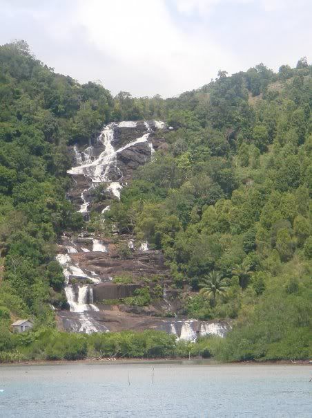
Temurun Falls


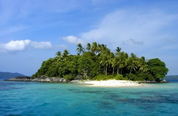
Langok Island


Semut (Ants) Island


Temawan Island


Bawah Island


Thứ Ba, 20 tháng 9, 2011

Sempu Island


If you like quiet place, where is no one around, isolated from the outside world, Sempu Island in Indonesia is the right place for you.
The long journey to reach the lagoon in the heart of the island paid off after you see magnificent white sand and blue water. Population is zero, no electricity and no drinkable water, except one hidden oasis in the deep jungle.
Sempu Island is located in the south of East Java Province, the nearest big city is Malang in the north. It is an isolated island with a small sea-lagoon, where most people camp on the sand nearby.

How to Get There?
The most popular hub to reach this place is Malang City. There is a daily train to reach Malang from Jakarta with various accommodations; executive, business, or economy. You may find several drivers in Malang Central Station offering you a pick up to the nearest harbour. They will cost you no more than US$ 5, try to keep the price under that amount, as some drivers may give you higher price. In some cases, you will be transferred to other drivers in Turen Market, it may cost you more. Just make it sure with the driver.


The next transit is Sendang Biru, a fisherman village where you need to rent a boat for crossing the strait. It will cost you around US$ 10, it includes the return fare. Ask for arranging return time.

After you reach the island, you still need to walk for an hour through the muddy jungle. Follow the existing track or you might get lost, I did get lost, which doubled my journey’s time.


Source:

Thứ Tư, 27 tháng 10, 2010

Merapi volcano, Yogyakarta

Merapi volcano is one of the world's most active and dangerous volcanoes. It contains an active lava dome which regularly produces pyroclastic flows. Eruptions occur at intervals of 1-5 years and are of low gas pressure. Since magma is poor in gas, eruptions are usually less than VEI 3 in size.
Merapi is one of the most active volcanoes in Indonesia and has produced more pyroclastic flows than any other volcano in the world. It has been active for 10,000 years.

Most eruptions of Merapi involve a collapse of the lava dome creating pyroclastic flows which travel 6 to 7 km from the summit. Some awan panas have traveled as far as 13 km from the summit, such as the deposit generated during the 1969 eruption. Velocity of pyroclastic flows can reach up to 110 km/hour. A slow up flow of andesitic magma leads to an extrusion of viscous magma, which accumulate and construct a dome in the crater.


Violent Eruptions at Merapi volcano
There is evidence that the current low level of activity may be interrupted by larger explosive eruptions. Eruptions of Merapi volcano during the 7–19th centuries A.D. were more violent than the past hundred years, and produced explosion pyroclastic flows. Widespread pyroclastic flows and surges traveled up to 25 km down the flanks of Merapi.
Scientists predict that the quiet of the 20th century will be broken by a larger
explosive eruption within coming decades. (Scientific report published in 2000).


2010 Eruption
Merapi volcano was raised to level 3 alert (out of a maximum 4) due to inflation and volcanic earthquakes on 21st October 2010. Sand miners were asked to stop all activity, and people advised not to climb the volcano.
Merapi volcano erupted on 26th October 2010 killing 13 people.

2006 Eruptions
Seismic activity began increasing at Merapi volcano in March 2006, and 10,000 residents were prepared for evacuation. On 10th April people were banned from climbing the volcano. On 12th April the Alert Level was raided from 2 to 3. An 8 km exclusion zone was placed around the volcano. On 27th April nearly 2,000 villagers were evacuated from Sidorejo and Tegalmulyo villages around Merapi volcano. On 13th May, the Alert Level was raised to the highest level 4, and about 4,500 people living near the volcano were evacuated. On 15th May pyroclastic flows traveled up to 4 km west. By 16th May, more than 22,000 people had been evacuated. On 8th June, the lava-dome growth rate at Merapi was an estimated 100,000 cubic meters per day, with an estimated volume of 4 million cubic meters. Pyroclastic flows and rockfalls decreased in frequency and intensity after 28th June 2006.

2001 Eruption
A major eruption began at Merapi volcano on 10th February 2001. A 30-minute-long pyroclastic flow occurred at 0200 hr. At 0330 hr there was a collapse of the 1998 lava dome which ejected ash 5 km above the summit and produced a pyroclastic flows that extended 7 km in the direction of the Sat River.

1998 Eruptions
Activity at Merapi volcano began increasing in July 1998. On 11th July 37 nuées ardentes occurred between midnight and 0500 hr. Between 11-19 July, 128 nuées ardentes occurred, including a strong pyroclastic ash and block flow at 1500 on 19th July.


1994 Eruptions
On 22nd November 1994, a large number of dome-collapse nuees ardentes were generated over a period of several hours at Merapi volcano. The nuees ardentes descended mainly the Boyong valley and the Bedog valley, a tributary of the Krasak-Kecil valley. This was in contrast to the 1984 and 1992 flows which traveled exclusively towards the southwest and west.

1986-87 Eruptions
Lava dome formation at Merapi volcano in 1986-87 was the largest since 1973.

1968 Eruptions
At the end of May 1968 a lava tongue had extended 875 m and was the result of new lava done extrusion after the 1967 collapse. The number of avalanches from the lava tongue were 1432 in June, 1370 July, 329 August, and 12 in September. Renewed activity began at Merapi volcano in October 1968 with an increasing number of lava avalanches.


1967 Eruptions
A lava dome extruded in April 1967 at the upper Batang River on the SW slope of Merapi volcano. The dome collapsed in October 1967.

1822 Lahar
A hot lahar at Merapi volcano on 28th December 1822 destroyed 4 villages with 100 casualties.

Merapi Volcano Eruptions

2010, 2007, 2006, 2001-02, 1992-98, 1972-90, 1971, 1967-69, 1961, 1953-58, 1948-49, 1944-45, 1942-43, 1939-40, 1933-35, 1930-31, 1924, 1923, 1922, 1920-21, 1918, 1915, 1909-13, 1908, 1906-07, 1905, 1902-04, 1902, 1897, 1894, 1893, 1891, 1889, 1888, ?1885, 1883-84, 1878-79, 1872-73, 1872, 1869, 1865-67, 1862-64, ?1854, 1849, ?1848, 1846-47, 1846, 1840, 1837-38, 1832-35, 1828, 1822-23, 1820-22, 1812-13, 1810, 1807, 1797, 1786, 1755, 1752, 1745, 1678, 1677, 1672, 1663, 1658, 1587, 1584, 1560, 1554, 1548, 7630 BC.

Source

Thứ Tư, 2 tháng 6, 2010

Lake Singkarak

Overview
The majestic Lake Singkarak (Danau Singkarak) is an enormous crater lake set within a dramatic volcanic landscape. Spread over two districts; Solok and Tanah Datar, the lake is a massive 1000 hectares. It is the widest lake in Sumatra and the second biggest lake on the island, after Lake Toba. A world of silent calm, breathtaking vistas and spectacular views awaits here. Here you can embrace the remote natural beauty that Indonesia is so famous for.

Locally Lake Singkarak is famous for its Bilih fish which is a species of fish that only lives in this lake. This fish is especially unique as it can’t survive anywhere but Lake Singkarak, not even in an aquarium.


Getting ThereLake Singkarak is located 70 km from Padang, 20 km from Solok and about 36 km from Bukittinggi.
From Minangkabau international airport, you can take a rented car or a public minibus plying the Padang-Solok route and then take other transportation to the lake. This journey will take you passed the Sitinjau Laut area which is famous for its sharp curves and steep canyons.


The most convenient way of getting around here is to drive. Lake Singkarak can also be reached by public transport.


To Do
 Bring your camera and capture the view of this beautiful lake. The best view of the lake is from the Solok-Bukittinggi main road, where visitors often stop to stock up on photos of the magnificent scenery.
The Tour di Singkarak is a major international cycling event, attracting teams from around the world who come to West Sumatra to battle it out in a grueling cycling competition. Racing through the regions most beautiful scenery over six days, riders finish the tour at the beautiful Lake Singkarak.
Test your nautical knowledge and explore the beauty of Lake Singkarak by boat. Boats are available for hire from vendors at the Lake.


Relax with a swim in the pristine waters of the lake. Several areas are suitable for swimming so take the opportunity to take dip in one of the most scenic swimming holes in the world.
Throw a line in and try your luck fishing. Test your skills and try to capture the famous bilih fish. If you drive to the lake, on your way you will pass through the charming hilltop village of Balimbing (the name means starfruit).


Thứ Tư, 26 tháng 5, 2010

Matano Lake; Another Heaven on Earth

Matano Lake is located in a small town named Sorowako, a distance of approximately 600 km southwest of Makassar, South Sulawesi. Arriving there, visitors will be greeted by the blue lake water, almost without a ripple. The water was so clear, until the bottom of the lake clearly visible. Anyone who saw it, seemed unable to resist the temptation to plunge into the water to enjoy the freshness and crystal clear water of this lake.

Enchantment of the lake is so tempting. Beautiful landscape and cool with lush forests on the shores of the lake. Do rafting on the lake covering 16 408 hectares, with an altitude of about 600 meters above sea level, is the most tourism activities carried people around.


With beautiful panoramic views and surrounded by Veerbec mountain forests, Lake Matano has become an attractive tourist destination. Besides swimming and rafting, a quiet lake has also become an appropriate location for various types of water sports such as screens, water skiing, canoeing and diving.


Most proud of this lake is a lake ecosystem which is still preserved and maintained since the 1930s to the present. For this reason, some scientists assess the Lake Matano deserves to be world heritage.

To reach this lake, visitors have to travel overland by bus-, air-conditioned bus for about 12 hours from Makassar, South Sulawesi provincial capital. Can also use the DASH-7 aircraft with a capacity of about 50 passengers, specially hired by PT. Inco to facilitate accessibility to Sorowako for both corporate and community interests.


Performed once daily flights from Hasanuddin Airport in Makassar at 12:00 pm while the flight to Makassar from Sorowako at 6:30 pm with any travel time approximately 85 minutes


Bài đăng phổ biến